
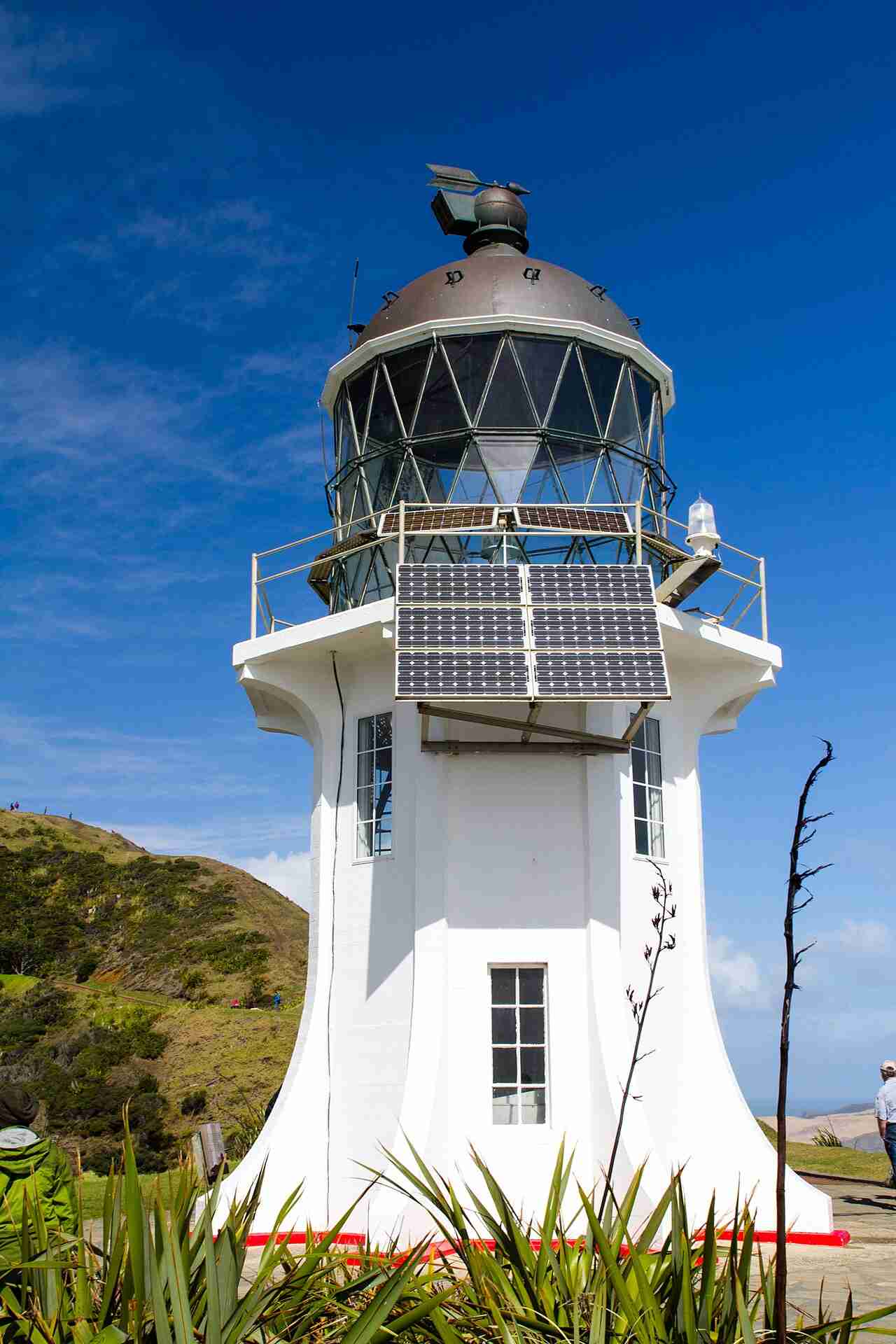
Cape Reinga Lighthouse stands at the north-western tip of the North Island, above the point where the Tasman Sea and the Pacific Ocean meet in a visible line of broken water. It was built in 1941, is a modest ten-metre tower with its light 165 metres above the sea, and has been automated since 1987. You can visit it any day for free, on a sealed road from Kaitaia and a short walk down from the car park. The headland is also Te Rerenga Wairua, one of the most spiritually significant places in New Zealand.
| Built | 1941, first lit May 1941 |
| Tower height | 10 metres |
| Focal height | 165 metres above sea level |
| Light | Flashing white every 12 seconds |
| Range | About 19 nautical miles, roughly 35 kilometres |
| Automated | 1987, last keeper left the same year |
| Region | Far North, Northland |
| Access | Public. Sealed road, then about 800 metres each way on a sealed path |
| Operator | Maritime New Zealand |
History
The first light to mark the far north was not at Cape Reinga at all. From 1879 a lighthouse stood on Motuopao Island, a small island off Cape Maria van Diemen a few kilometres to the west. The island was exposed and hard to supply, and landing keepers and stores there was dangerous, so in 1938 the decision was made to move the light onto the mainland at Cape Reinga.
The new lighthouse was built in 1941 and first lit that May. It was the last manned lighthouse built in New Zealand. The lantern and lens fittings from the old Motuopao light were shipped round and reused at the new tower. Keepers and their families lived at the isolated station for decades, more than a hundred kilometres from the nearest town, until the light was automated in 1987 and the last keeper left.
The tower
The tower itself is small, about ten metres tall and painted white, which surprises many visitors who expect something grander at such a famous spot. What gives it reach is the cliff. The light sits 165 metres above the sea, so its focal height does the work the short tower cannot. It flashes white once every 12 seconds and can be seen for about 19 nautical miles, roughly 35 kilometres out to sea. The original lamp and lens served until 2000, when they were replaced by a compact solar-powered beacon. Maritime New Zealand owns and monitors it remotely from Wellington, as it does with every lighthouse in the country.
Visiting Cape Reinga Lighthouse
Cape Reinga is the most visited lighthouse in New Zealand, and getting there is far easier than it once was. The road from Kaitaia is now sealed the whole way, State Highway 1 to the very tip, and the drive takes around 90 minutes to two hours depending on stops. There is a large public car park at the end.
From the car park a sealed, well-formed path leads down to the lighthouse, about 800 metres each way. It is a gentle 10 to 15 minutes downhill on the way there and a steeper climb back up, and most of it is suitable for pushchairs and anyone reasonably mobile. There is no charge and no gate. Bring water, sun cover and a warm layer, because the headland is exposed and the wind can be strong even on a fine day.
The headland is a sacred site, so the Department of Conservation and local iwi ask visitors to treat it with respect. Please do not eat food anywhere on the headland, though drinking water is fine, stay on the marked paths, and leave dogs and other pets at home. There are no rubbish bins, so take everything out with you.
Explore the data. See how Cape Reinga fits with every other light around the coast, with build years, heights and access notes, on our interactive New Zealand lighthouses map.
Te Rerenga Wairua, the leaping place of spirits
For Māori, Cape Reinga is Te Rerenga Wairua, the leaping place of spirits. In tradition the spirits of the dead travel north along the country to this headland, descend the roots of a lone, wind-shaped pōhutukawa tree clinging to the cliff, and depart from here on their journey back to the ancestral homeland of Hawaiki. It is one of the most spiritually significant places in the country, which is why visitors are asked to walk quietly and to keep the cultural protocols above.
The meeting of two seas below the lighthouse carries meaning too. On many days you can clearly see the tide line where the Tasman Sea meets the Pacific Ocean, a churning band of water offshore that draws every visitor’s eye almost as much as the lighthouse itself.
Frequently asked questions
Can you visit Cape Reinga Lighthouse?
Yes. It is open to the public every day and free to visit. You drive to the car park at the end of State Highway 1 and walk about 800 metres down a sealed path to the lighthouse. You cannot go inside the tower, but you can walk right up to it.
How long is the walk to the lighthouse?
About 800 metres each way. It takes roughly 10 to 15 minutes to walk down and a little longer to climb back up. The path is sealed and suitable for most visitors, including pushchairs.
Is Cape Reinga Lighthouse still working?
Yes. It is an active navigation light, automated since 1987 and monitored remotely by Maritime New Zealand. It flashes white every 12 seconds from a solar-powered beacon.
Related guides and sources
- New Zealand Lighthouses Explorer, our interactive map of every major light around the coast.
- Maritime New Zealand on the Cape Reinga light.
- Department of Conservation on visiting Cape Reinga / Te Rerenga Wairua.
Make a day of it. Cape Reinga pairs naturally with the giant Te Paki sand dunes, where you can sandboard down to the Te Paki Stream, and the long sweep of Ninety Mile Beach on the drive up or back from Kaitaia.