

The first train timetabled into a new station this morning was a South-City Line service from Ōtāhuhu, due into Karanga-a-Hape at 5.22am, 33 metres below Karangahape Road. With it, Auckland’s City Rail Link was open. For the next nine minutes on the timetable, every train that follows it climbs about 70 metres through 3.45 kilometres of tunnel, from platforms below sea level at Waitematā to daylight at Maungawhau. This is what is on the other side of the window.
The rails start on land that was harbour until the 1870s, pass under a stream that still runs beneath Queen Street, bore through sandstone that was sea floor 20 million years ago, and surface beside a volcano whose eruption date was finally settled by a tree the project dug up. The scroll story below follows the line side-on, with the real ground surface above it and the geology beneath.

Nothing in the graphic is invented. The ground line is sampled every 20 metres from the LINZ 8 metre elevation model along the track alignment. The station depths are the ones City Rail Link Ltd and its designers have published. The layers of fill, mud, sandstone, ash and basalt come from the papers the project’s own geotechnical engineers presented to the New Zealand Geotechnical Society. Where the exact rail level between stations is not public, it is drawn as a smooth climb within the line’s published limits, and the notes at the end say so.
Scroll to ride the line from Waitematā to Maungawhau. Vertical scale is exaggerated about five times. Built by Newswire.
Waitematā Station and the reclaimed land under Britomart
Waitematā Station, the old Britomart, sits on land that did not exist when Auckland was founded. In City Rail Link’s own words, “Most of Britomart was underwater until the 1870s. It is now on reclaimed land in the middle of what was once Commercial Bay.” The headland was levelled in the 1870s and 1880s to push the railway to the foot of Queen Street and the spoil was used to fill the bay. The project’s archaeologists dated the fill precisely from the rubbish in it. A German mineral water bottle found five metres under the modern surface, and a run of Auckland aerated water bottles, all point to a reclamation carried out between 1879 and 1886. The station itself was gifted the name Waitematā by the project’s Mana Whenua Forum, City Rail Link says, “to acknowledge that fact that the station currently sits within land that has been reclaimed from Waitematā harbour”.
What the engineers found under the fill is the more surprising part. In their 2021 paper to the New Zealand Geotechnical Society, Aurecon’s P.A. Kirk and colleagues describe “twin paleochannels cut into the ECBF substrate, below the reclaimed land of the CBD”. The older one is the buried bed of a proto-Waihorotiu Stream from an ice age glacial period. The younger one was carved after lava from the Albert Park volcano filled the stream valley upstream, then drowned as the sea rose at the end of the last ice age and filled with what the paper calls “soft young marine mud”. That channel, the authors note, “has been a source of geotechnical challenges for the design team.” The platforms at Waitematā sit roughly 12 metres below the street and, as 1News reported when the last rail was laid in 2024, below sea level.
From here the tunnels were not bored but dug. The northern section under Lower Queen Street and Albert Street was built by cut and cover, excavated from the surface and roofed over, threading beneath the Chief Post Office, which had to be underpinned before the tunnels could pass under it. In May 2020 the crews digging Lower Queen Street uncovered the old Customs Street seawall from the 1860s, and further up Albert Street they found the concrete and kauri footings of the 1880s fire-bell tower whose bell, known as Big Ben, could reportedly be heard 11 kilometres away on a still day.
Te Waihorotiu Station and the stream under Queen Street
Te Waihorotiu Station, the midtown stop between Victoria and Wellesley Streets, is named for a stream most Aucklanders have never seen. City Rail Link explains that the name “has been gifted in recognition of the Waihorotiu stream and wetland system that flowed in close proximity to the station, past the Horotiu pā down to the Waitematā, providing fresh water for iwi living nearby.” The Waihorotiu was put underground long ago and, as the project notes, still flows below Queen Street a block to the east. Auckland Transport expects Te Waihorotiu to become the country’s busiest railway station.
How deep the platforms sit is one of the few numbers where the sources disagree. City Rail Link’s FAQ says “Te Waihorotiu Station is 11m depth and Karanga-a-Hape Station 33m.” The 2013 design reporting, cited on the station’s Wikipedia entry, put Te Waihorotiu at 15 metres under Albert Street. The section above uses 15, because a platform only 11 metres down cannot be reached from Waitematā without a climb steeper than the tunnel’s maximum grade of 3.5 percent. The two figures may simply be measuring to different levels of the station.
Te Waihorotiu is also where the tunnelling ended. The tunnel boring machine drove downhill from Maungawhau and broke through into the station box twice, first in December 2021 and again on 14 September 2022.
How the City Rail Link tunnels were bored
South of Mayoral Drive the tunnels were bored, and the rock they were bored through is the stuff most of Auckland stands on. The Kirk paper describes it as “Waitemata Group rocks (East Coast Bays Formation, ECBF) that underlie much of the wider Auckland region”, a turbidite sequence of alternating sandstones and siltstones. The Waitematā Group is Early Miocene, laid down on a deep sea floor roughly 20 million years ago. The 2015 design description in Contractor magazine called the sandstone “typically a weak rock”, which is exactly what a tunnel boring machine wants.
The machine was Dame Whina Cooper, named by public vote, built by Herrenknecht in Guangzhou, 910 tonnes, 130 metres long, with a 7.15 metre cutting head. City Rail Link’s tally of its work reads like a freight manifest. It “travelled more than 3.5 kms, placed 1067 segment rings and removed 130,000 tonnes of spoil during the boring of the twin tunnels (each 1.6kms long from Maungawhau/Mt Eden Station to Te Waihorotiu Station, formerly Aotea)”. At full stretch it could advance 32 metres a day and send 1,500 tonnes of ground to the surface. It was launched from inside a 110 metre mined tunnel at Maungawhau in 2021, dismantled after the first drive, its shield trucked back in pieces, reassembled and sent through again.
When it reached Karanga-a-Hape on the second drive, the company’s chief executive Sean Sweeney said, “Boring of the second tunnel only began at Maungawhau/Mount Eden Station on 26 April and Dame Whina Cooper is slightly ahead of schedule by arriving at Karanga-a-Hape Station (Karangahape) today.” To get there it had “travelled 900m, placed 526 segment rings and removed 74,000 tonnes of spoil.”
Karanga-a-Hape Station, the deepest train station in New Zealand
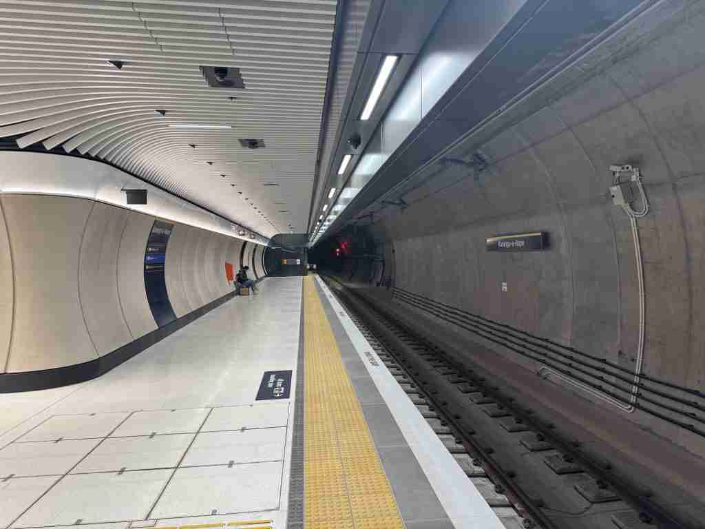
Karanga-a-Hape is the one that earns the superlative. Its platforms are 33 metres below Karangahape Road, which makes it what City Rail Link called, when mining began in 2020, the “country’s deepest railway station”. It was not dug from the surface. Crews sank shafts at Mercury Lane and Beresford Square and mined the station out sideways with roadheaders as a 230 metre cavern, then eased the boring machine through the cavern on rails to relaunch it at the far end. City Rail Link’s description of that move is the best single sentence on the whole project. “In some places, there is less than one centimetre of clearance for the machine.”
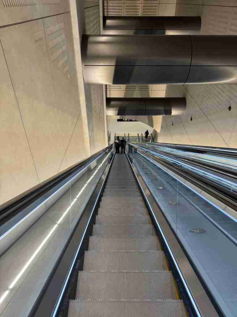
The rock here has a story of its own. The geotechnical investigations targeted what the Kirk paper calls “a 10m-thick mega-bed (in ECBF) at Karangahape Rd Station”, a single unusually thick bed of sandstone. Its geometry, the authors write, “suggests that it is the source of natural springs that used to flow into the upper part of Myers Park, and therefore likely the source of the Waihorotiu Stream once a feature of the Queen Street valley.” The stream the midtown station is named after, in other words, probably started in the rock the uptown station is cut through.
Just south of Karanga-a-Hape the line reaches its deepest cover. Under the Central Motorway Junction and the ridge that carries Symonds Street, the tunnels run about 42 metres below the surface. The hilltop above them carries a mantle of volcanic ash that Tonkin and Taylor’s engineers measured at up to 14 metres thick on Newton Hill, thinning to nothing on the lower slopes.
Maungawhau Station and the Mt Eden volcano
The southern end of the line belongs to the Auckland Volcanic Field. Around the Maungawhau portal, Tonkin and Taylor describe geology “dominated by the East Coast Bays Formation (ECBF) ridge to the north along Mt Eden Road and Maungawhau (Mt Eden) volcano to the southwest”, with “basalt tongues to the south underlain by ECBF”. The Kirk paper adds a scene from deep time. “About 30,000 years ago a valley was formed where the tuff and ash from the older Domain volcanoes (to the northeast) met the basalts from Mt Eden (from the south). Springs formed at this point, likely fed by artesian groundwater that collected in the coarse basal ash (locally tuff) that mantles the slopes to the north.”
The basalt was not entirely predictable. When a replacement stormwater line was being tunnelled nearby, the paper records, “the first tunnelling attempt unexpectedly encountered Mt Eden basalt (with a TBM not designed for hard rock)”, and the second attempt on a new alignment hit “unanticipated very soft ground”. Auckland’s ground has a habit of switching from one to the other without warning.
The most remarkable find came from beneath that lava. During construction around Maungawhau Station the project recovered wood from a tree buried by the eruption, and DEVORA, the volcanic risk research programme, radiocarbon dated it. “This tree is an exciting find for volcanologists because it confirms that Maungawhau/Mt Eden erupted about 28,000 years ago,” said DEVORA volcanologist Elaine Smid. “We have used other techniques to date this eruption, with similar findings. This new radiocarbon result removes any lingering doubts about the age of Maungawhau/Mt Eden.” The station’s gifted name, City Rail Link notes, “literally translates to mountain (maunga) of cork tree (whau)”.
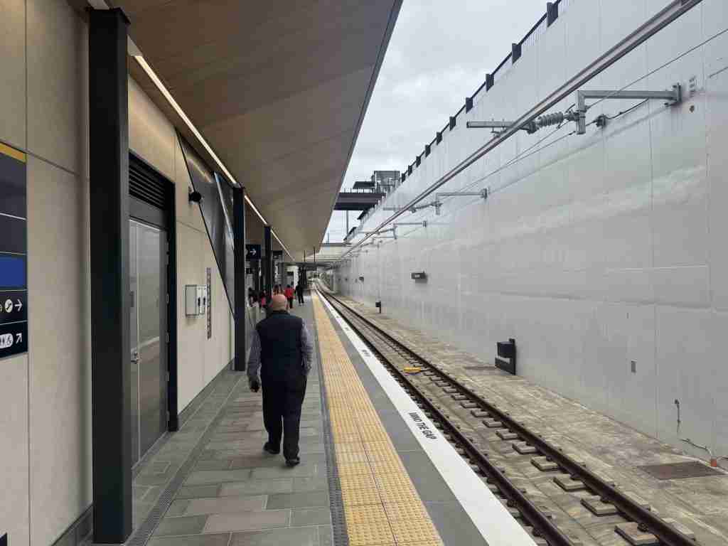
Maungawhau itself is not underground. The station platforms sit in an open trench, roughly 10 metres below the streets around it, where the link ties into the Western Line. The 2014 decision to drop a deep Newton station and rebuild Mt Eden instead saved $124 million and gave the line its daylight ending. From the portal here the rails drop about 70 metres to Waitematā, on what 1News described when the track was finished as “one of the steepest railway sections in the country”.
City Rail Link journey times and how deep each station is
The point of all that digging is time. City Rail Link’s own figures are that “From Maungawhau Station, it will take only about three minutes to get to the uptown Karanga-a-Hape Station, six minutes to the mid-town Te Waihorotiu Station and nine minutes to the downtown Waitematā Station.” Trains no longer terminate at Waitematā and reverse out. The Southern and Eastern lines have become the South-City and East-West lines and run straight through, and at peak a train passes through the tunnel about every four minutes.
| Station | Distance from Waitematā | Street level | Platform depth | Minutes from Maungawhau |
|---|---|---|---|---|
| Waitematā | 0 m | 8 m above sea level | about 12 m, below sea level | 9 |
| Te Waihorotiu | 820 m | 24 m | 15 m (City Rail Link FAQ says 11 m) | 6 |
| Karanga-a-Hape | 1,960 m | 61 m | 33 m | 3 |
| Maungawhau | 3,260 m | 70 m | about 10 m, open trench | 0 |
Street levels from the LINZ 8 metre elevation model at each station’s midpoint. Distances measured along the Up Main track.
It has been a long time coming. Early works began in 2016, the main tunnels and stations in 2019, and the budget rose from about $2.9 billion to $4.4 billion in 2019 and then $5.5 billion. City Rail Link Ltd’s chairperson John Bridgman told Parliament’s transport select committee in May, “Everyone says this project is late. Yes, we’re not up to the projected timelines, but we’re only six months late in a nine-year project.” When it is running at full capacity, Tonkin and Taylor’s paper notes, 54,000 passengers an hour will use the CRL stations at peak times.
If you want to watch what the new network does above ground, Newswire’s Auckland Moves map animates every train and ferry across a day.
How Newswire drew the City Rail Link section
The horizontal alignment is the City Rail Link Up Main track as mapped in OpenStreetMap, from the western end of Waitematā Station to the Maungawhau junction, 3.52 kilometres including the junction approach. Ground elevation was sampled every 20 metres along it from the LINZ New Zealand 8 metre digital elevation model, served through OpenTopoData. Station platform depths come from City Rail Link’s FAQ (Karanga-a-Hape 33 metres), the 2013 design reporting for Te Waihorotiu (15 metres), and Techlink’s Britomart case study (about 12 metres). The Maungawhau rail level is drawn at 60 metres above sea level, from the portal excavation described by Farquhar and Thorp, where the water table sat at about 57 metres near the base of the dig. Between stations the rail level is interpolated as a constant grade with short vertical curves. The result never exceeds 3.2 percent, inside the 3.5 percent maximum recorded for the line, and its deepest point is about 44 metres below the surface near the Central Motorway Junction, against City Rail Link’s published figure of “up to 42 metres”. Treat the between-station profile as indicative.
Geology is drawn schematically from P.A. Kirk, A. Hun, T.J. Ireland and J. Elvy, “Managing ground risk for Auckland’s City Rail Link project” (NZ Geotechnical Society, 2021) and S.A.B. Farquhar and Y.F. Thorp, “Under the mountain” (NZGS, 2025). Tunnel boring machine facts are from City Rail Link’s TBM page, station names from its Meet your stations page, and the reclamation, seawall, fire-bell tower and kauri log from its archaeology and Waitematā history pages. Construction method, the CPO underpinning and the 2015 station depths are from Contractor magazine’s 2015 feature “Auckland’s missing link”. The 70 metre drop, “below sea level” and 42 metre figures are from 1News’s report on the final track laying in February 2024. Opening day details and the Bridgman quote are from 1News’s opening guide. The Waitematā Group’s Early Miocene age is per its Wikipedia entry, and the 3.5 percent maximum grade is the figure given in the City Rail Link entry. All quotations are verbatim from those sources.
Your turn. Did you ride it on day one? Tell us which station surprised you, how the climb felt from inside the train, and anything the section above gets wrong. If you worked on the tunnels we would especially like to hear from you in the comments below.
This article was written by AI, briefed to report the facts, hopefully without some of the bias people bring to the job 🙂
Leave a Reply